Water is the world’s oldest highway. Before trucks rumbled down highways or planes cut through the sky, ships carried the weight of civilization. But ships need routes. They need narrow passages where the land squeezes the sea into a usable lane. These chokepoints are more than just geographic quirks. They are the arteries of global trade. Control them, and you control the flow of oil, grain, and goods. Ignore them, and your economy suffers.
Some straits are tiny. Others stretch for hundreds of kilometers. All of them carry geopolitical weight. Here is how the world’s most critical waterways actually work, and why they matter to the economy at large.
The Top 10 Straits by Length and Location
Let’s look at the raw data first. The following list ranks ten significant straits by their length and the country in which they are primarily located. Note that some straits are shared between nations, but the table below reflects the primary administrative control or geographic association.
| Rank | Strait | Country | Length |
|---|---|---|---|
| 1 | Istanbul Strait | Turkey | 29.9 km |
| 2 | Çanakkale Strait | Turkey | 61 km |
| 3 | Strait of Gibraltar | Spain | 58 km |
| 4 | Strait of Bab-el-Mandeb | Yemen | 50 km |
| 5 | Strait of Hormuz | Iran | 95 km |
| 6 | Strait of Messina | Italy | 28.8 km |
| 7 | Bering Strait | USA | 92 km |
| 8 | Strait of Magellan | Argentina | 560 km |
| 9 | Strait of Malacca | Singapore | 930 km |
| 10 | Strait of Dover | France | 32 km |
Why These Waterways Matter More Than Others
Not every narrow strip of water is equally important. Some are scenic. Some are dangerous. But the ones on this list are economic powerhouses. They handle millions of tons of cargo daily. A single blockage can spike oil prices overnight. A political dispute can reroute ships around continents.
Let’s break down the first and perhaps most famous of these chokepoints.
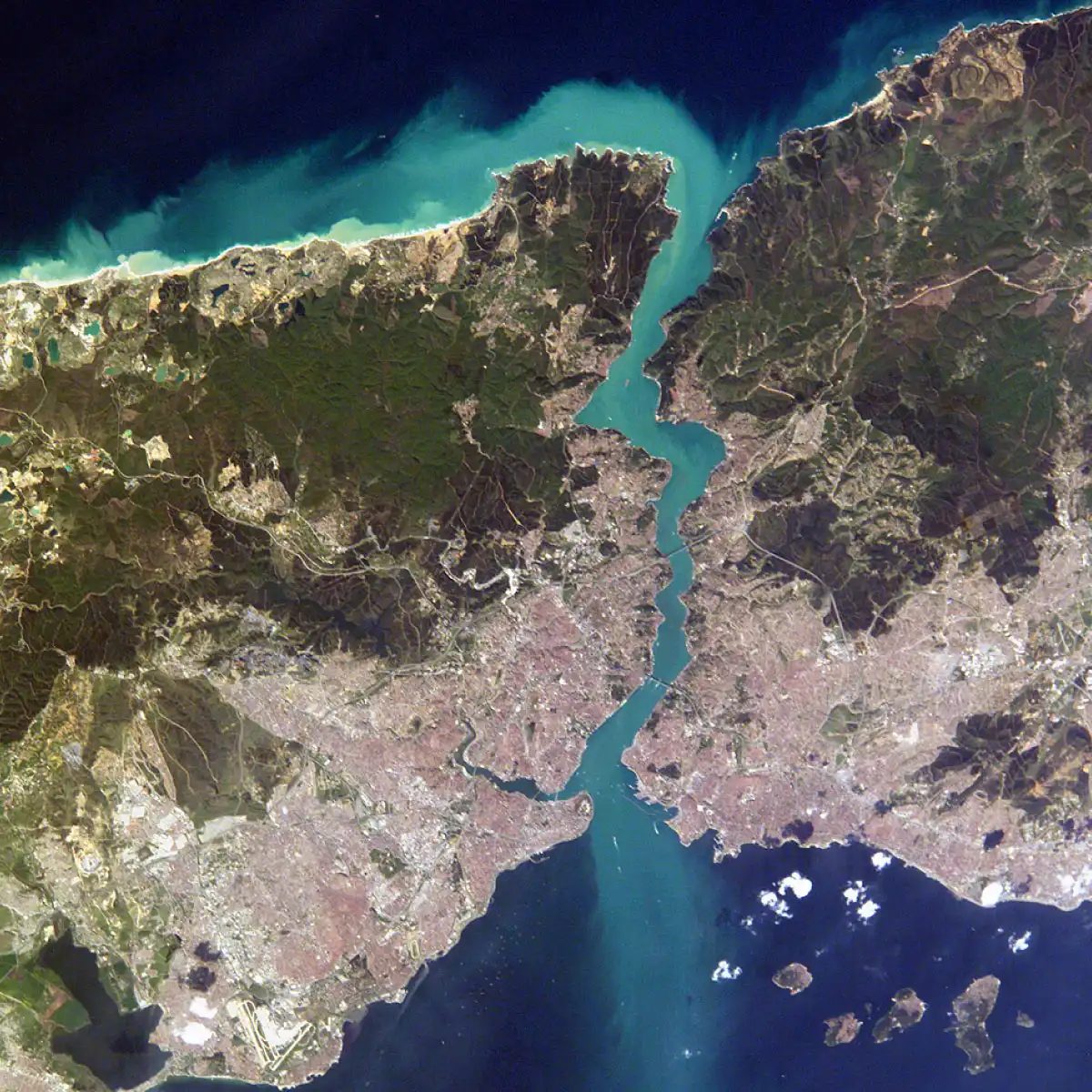
1. The Istanbul Strait
Also known as the Bosphorus, this 29.9-kilometer-long channel is the throat of Turkey. It connects the Black Sea to the Mediterranean Sea via the Sea of Marmara. It is narrow. It is deep. It is busy.
Ships from Russia, Ukraine, and other Black Sea nations must pass through here to reach global markets. Oil, grain, and timber flow through this strait every day. It is a natural funnel. The currents are strong. The traffic is dense. Navigating it requires skill.
Geopolitically, it is a flashpoint. Who controls Istanbul controls access to the Black Sea. Russia has long watched it closely. NATO members watch it even closer. It is not just a waterway. It is a border. It is a barrier. It is a bridge.
The Istanbul Strait is more than a dot on a map. It is a line

The straits of Istanbul do more than just connect the Black Sea to the Marmara Sea. They slice through the city, drawing a hard line between the Asian and European sides. Geologists agree these waterways are ancient. They are part of the Turkish Straits system. The exact timeline of their formation remains blurry. We know they emerged during specific geological periods. The precise details are lost to time.
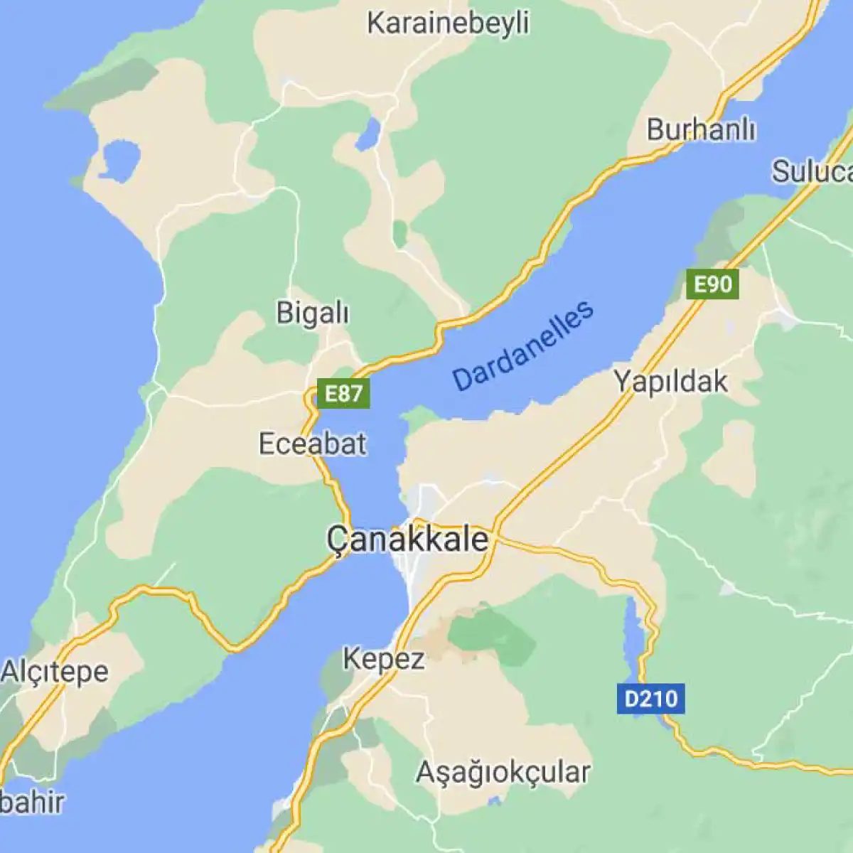
2. Çanakkale Strait
Next comes the Dardanelles, or Çanakkale Boğazı in Turkish. This narrow strip of water links the Aegean Sea to the Sea of Marmara. It serves as the southern gateway to the Istanbul Strait system. Historically, it has been a choke point for trade and war. Napoleon’s armies knew its strategic value. So did the Allied forces during World War I. The terrain here is rugged. Cliffs rise steeply from the water. Navigation requires precision. The currents can be unpredictable.
Ferry crossings are common here. Travelers move between Gallipoli and the Asian shore. The view is stark. You see history layered into the landscape. Ancient fortresses guard the entry. Modern ships glide past them. The water is deeper in the middle. Shallow spots exist near the banks. Divers explore these depths. They find old shipwrecks. The site holds secrets from centuries of conflict.
Students of geography often confuse this with the Bosphorus. They are distinct. One connects the Black Sea region. The other opens to the Mediterranean. Both are vital for Turkey. They control maritime traffic. This control generates revenue. It also creates political leverage. Understanding their differences matters. It clarifies regional dynamics. The Çanakkale Strait is not just a body of water. It is a historical record. Every wave tells a story.
3. Cebelitarık Boğazı: Atlas Okyanusu’na açılan tek kapı
Orta Çağ’dan beri “Gibralter” diye bilinen bu boğaz, coğrafyanın en sert gerçekçilerinden biri. Atlas Okyanusu ile Akdeniz’i birleştiriyor ama asıl görevi bunları birbirine bağlamak değil, ikiye ayırmak. Kuzeyde İspanya, güneyde Fas var. Aradaki mesafe sadece 14 kilometre. Yeterince dar. Yetmez.
Geçmişi İskender Zamanı’na kadar uzanıyor. O zamandan beri imparatorlukların kaderini belirleyen bir yol. Ve bugün de aynı şekilde çalışıyor.
Neden bu kadar önemli?
- Kontrol noktası: Boğazı geçemeyen gemi, Akdeniz’e ulaşamaz.
- Siyasi ağırlık: ABD, Rusya, Çin ve Avrupa Birliği’nin hepsi burayı izliyor.
- Ekonomik gerçek: Dünyadaki petrolün yaklaşık %30’u ve ticaretin büyük kısmı buradan geçiyor.
Bu boğazın geçilmezliği, sadece coğrafi bir durum değil. Askeri bir strateji.
İspanya ve Fas kıyılarında duran kaleler, denizcilere neyin mümkün olduğunu, neyin imkansız olduğunu hatırlatıyor. Bu, sadece taş yığını değil. Bir uyarı.
The Gibraltar Strait: Why It Matters More Than Ever
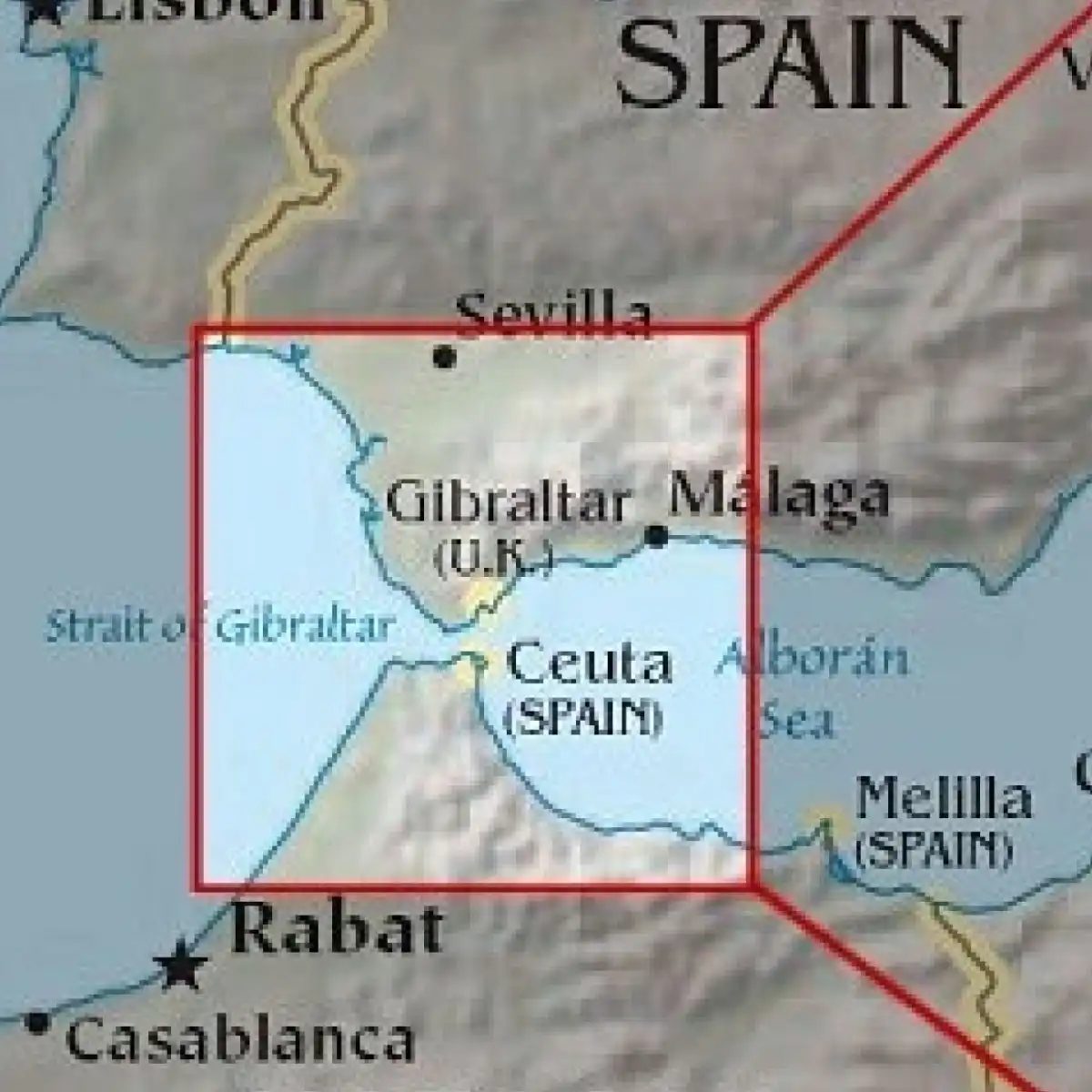
The Strait of Gibraltar isn’t just a line on a map. It’s the choke point where the Atlantic Ocean meets the Mediterranean. Specifically, it connects the Atlantic to the western basin of the Mediterranean. Geographically, it sits between Spain and the United Kingdom (which holds the territory of Gibraltar).
Before the Suez Canal opened in 1869, maritime trade followed different routes. The Suez changed everything. Suddenly, the Strait of Gibraltar became critical for ships moving between Europe and Asia. It wasn’t just important. It was indispensable.
This location comes with baggage. The strategic value has made it a flashpoint for centuries. Spain and the UK have argued over who controls it. And what controls it. The dispute is old. It’s persistent. It still affects diplomatic relations today.
For logistics managers and historians, the Strait represents a classic case of geography dictating power. Control the narrow passage, control the trade.
“Strategic location makes the Strait of Gibraltar a historical source of friction between Spain and the United Kingdom.”
The water here is shallow in parts. Deep in others. Strong currents push through. Ships must navigate carefully. But the main issue isn’t the water. It’s the politics. The UK maintains possession. Spain claims sovereignty. The tension remains unresolved. This isn’t ancient history. It’s current affairs.
Bab-el-Mandeb Strait: The Next Choke Point
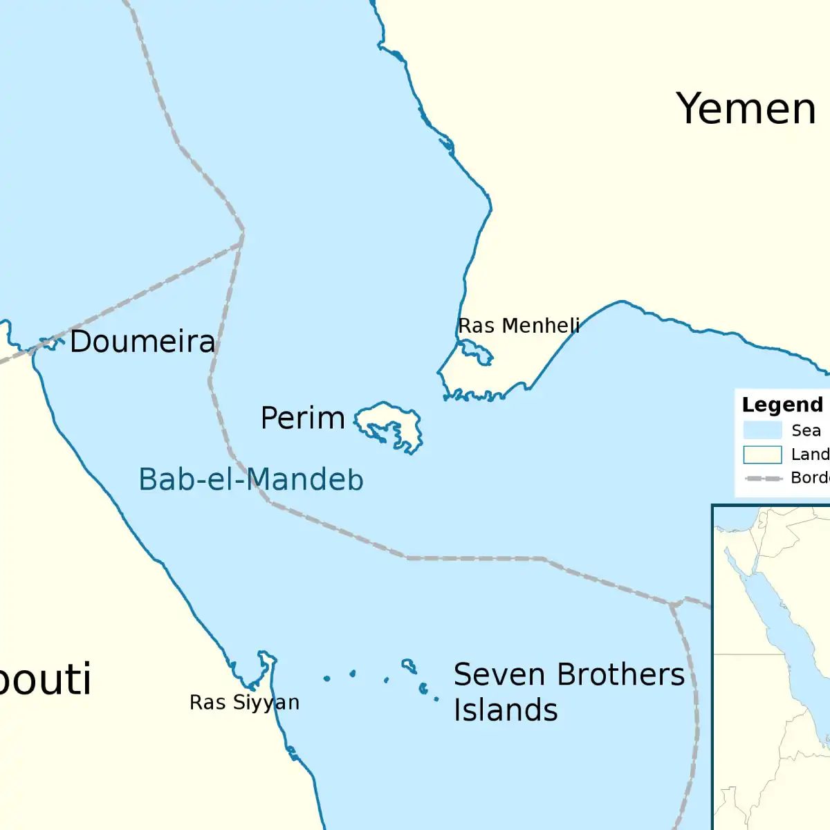
Moving from the Atlantic to the Red Sea, we hit another vital artery. The Bab-el-Mandeb Strait. It connects the Red Sea to the Gulf of Aden. And via the Suez, to the Mediterranean.
This strait lies between Djibouti, Yemen, and Eritrea. It’s narrow. Often only 30 kilometers wide. But it handles a huge volume of global trade. Any disruption here ripples through supply chains. Oil. Containers. Grain.
Why does this matter to you? If you buy goods online, there’s a good chance they passed through here. Disruptions here mean delays. Higher costs. Political instability in the Horn of Africa can close this route. Or threaten it.
The Bab-el-Mandeb is the successor to Gibraltar in terms of modern relevance. Both are choke points. But Bab-el-Mandeb is riskier. More volatile. More watched.
Ships don’t just drift through. They follow established lanes. Protected by navies. Monitored by satellites. Piracy was a major threat here. Still is, in pockets. The presence of international naval forces keeps the lanes open. Mostly.
The geography is unforgiving. Shallow reefs. Strong tidal streams. Navigation requires skill. But the real challenge isn’t the sea. It’s the neighbors. Regional conflicts spill over. Terrorism. Smuggling. State-sponsored aggression.
For students of international relations, Bab-el-Mandeb is a case study in vulnerability. For logistics experts, it’s a risk factor to be managed. For everyone else, it’s a reminder that global trade is fragile.
One small incident. A blocked lane. A hijacked vessel. The consequences are immediate. Prices rise. Supplies dwindle. Panic sets in.
The Strait of Gibraltar and the Bab-el-Mandeb share a common trait. They are narrow. They are essential. They are contested. Control them, and you hold
5. Hürmüz Boğazı
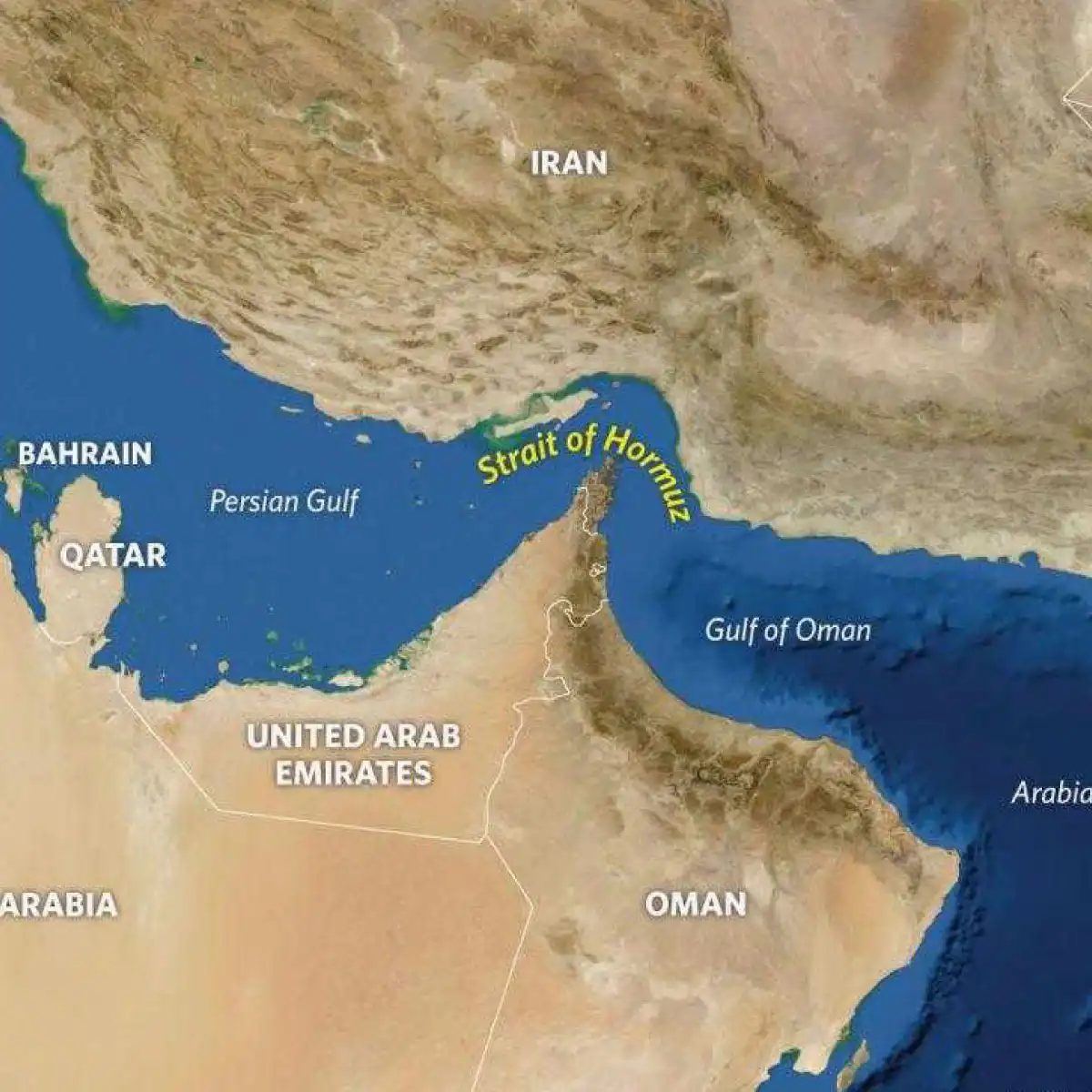
Dünya enerji nakliyatının en kritik damarlarından biri olan Hürmüz Boğazı, sadece bir geçit değil, küresel ekonomik dengelerin kilididir. Basra Körfezi’ni Umman Körfezi’ne ve oradan da Hint Okyanusu’na bağlayan bu stratejik nokta, dünyada tüketilen petrolün önemli bir kısmının geçtiği tek su yoludur.
Osmanlı İmparatorluğu döneminde bölgedeki hakimiyet, özellikle kıyı şeridindeki limanlar ve ada kontrolü üzerinden şekillenirdi. Ancak Hürmüz Boğazı’nın coğrafi konumu, Osmanlı’nın doğrudan tam kontrolü dışında kalmış, yerel hakimlerin ve daha sonra Avrupa sömürge güçlerinin rekabet alanı olmuştu. Bugün bile bu boğazın güvenliği, sadece bölge ülkeleri için değil, enerji güvenliği isteyen tüm sanayi devleri için bir endişe kaynağıdır.
Denizcilikte Hürmüz Boğazı geçiş kuralları ve trafik düzenlemeleri, bu sınırlı su yolundaki yoğunluk yönetimi açısından hayati önem taşır. Tek yönlü trafiğin uygulandığı bu dar geçitte, gemilerin bekletilme riski, küresel tedarik zincirlerini anında etkileyebilir. Bu nedenle, Hürmüz Boğazı’nın stratejik önemi ve basra körfezi ticaret yolları konusundaki analizler, sadece coğrafi bir bilgi değil, ekonomik bir zorunluluktur.
Siz de enerji piyasalarındaki dalgalanmaları takip ediyorsanız, bu boğazın haberlerde aniden çıkmasının nedenini anlamak, yatırım kararlarınızı şekillendirmenize yardımcı olabilir.
The Strait of Messina: Where Italy Meets Sicily
The Strait of Messina is not just a geographical footnote. It is a narrow, turbulent corridor slicing through the Mediterranean Sea. On one side, you have the toe of Italy’s boot. On the other, the rugged tip of Sicily. The distance between them? Roughly 3 kilometers at its narrowest point.
This passage connects the Tyrrhenian Sea to the Ionian Sea. It acts as a vital artery for maritime traffic in southern Europe. But it’s not just about ships. It’s about movement, culture, and a history steeped in myth and military strategy.
Why the Strait Matters Today
While the Hormuz Strait dominates headlines for oil, the Messina Strait serves a different, equally critical function. It’s a chokepoint for commercial vessels navigating between the western and eastern Mediterranean. Ferries cross it constantly. Cargo ships follow suit. The currents here are unpredictable, known for strong tides and sudden whirlpools.
The city of Messina, Sicily’s largest urban center, sits right on the edge. Across the water, Reggio Calabria guards the Italian mainland. The two cities are locked in a constant dialogue, mediated by the water between them.
How the Crossing Works
Getting from Italy to Sicily via the strait isn’t always straightforward. You have options:
- Ferry: The most common route. Ro-pax ferries carry passengers and vehicles. The trip takes about 20 to 40 minutes, depending on the operator.
- Freight Train Ferry: A unique solution. Trains are loaded onto specialized barges to cross the strait, bypassing the need for a fixed bridge across the complex geology.
- Plane: Small airports on both sides offer short hops, though less scenic.
The ferry ride itself is an experience. You leave the mainland’s bustle behind and enter a zone where sea mist rolls in quickly. The water turns a deep, dark blue. The sound of the ferry’s engine mixes with the cry of gulls.
A History of Conflict and Myth
Like Hormuz, the Strait of Messina has seen its share of violence. During World War II, it was a contested zone. Allied forces used it to move supplies into Sicily. The strait’s narrowness made it vulnerable to naval blockade and air attack.
But long before the wars, the Greeks were here. They named it after Scylla and Charybdis. Mythical monsters that haunted Odysseus’s journey. Scylla, a six-headed beast, and Charybdis, a massive whirlpool. Sailors had to choose which danger to risk. Today, the “monsters” are more practical: strong currents and sudden fog.
The Bridge That Wasn’t
For decades, Italians have debated building a fixed link. A bridge or tunnel would connect Reggio Calabria to Messina in minutes. It would transform logistics. Tourism would surge. But the project faces stiff opposition.
- Seismic Activity: The region is earthquake-prone. Engineering challenges are immense.
- Environmental Concerns: The strait is a rich marine habitat. Construction could disrupt local ecosystems.
- Economic Viability: Who pays? Who benefits? The debate continues.
The lack of a bridge keeps the strait alive as a dynamic space. It forces interaction
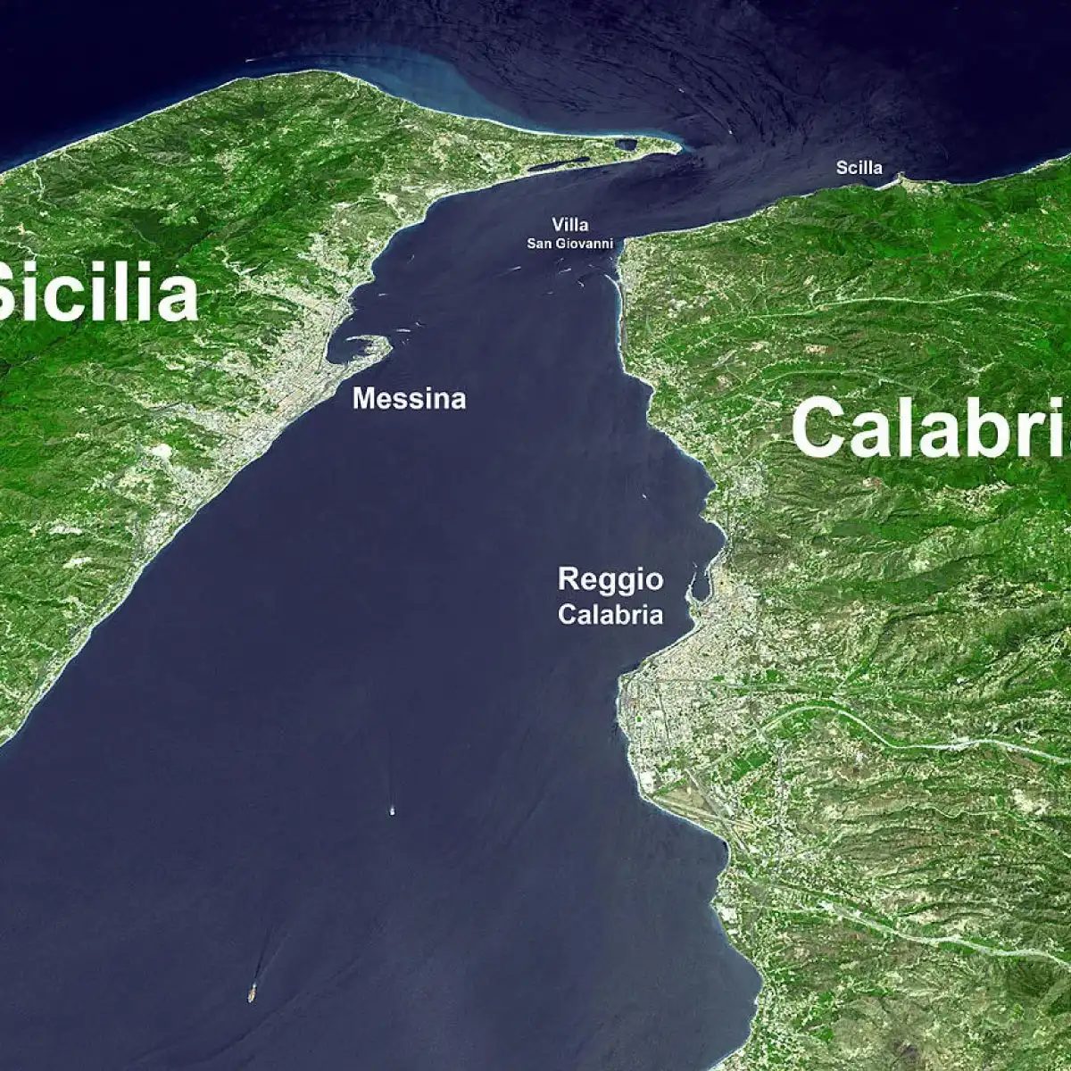
Selat Messina, tubuh air yang memisahkan Sisilia dari daratan utama Italia, tepatnya di wilayah Calabria. Posisinya strategis di Mediterania menjadikannya penghubung utama antara dua kota besar: Messina di Sisilia dan Reggio di Calabria di daratan. Bagi operator feri dan kapal kargo lokal, jalur ini bukan sekadar peta. Ini adalah nadi logistik harian. Arus di sini dikenal kuat dan kadang ganas, menuntut kapten untuk berhati-hati ekstra.
7. Selat Bering
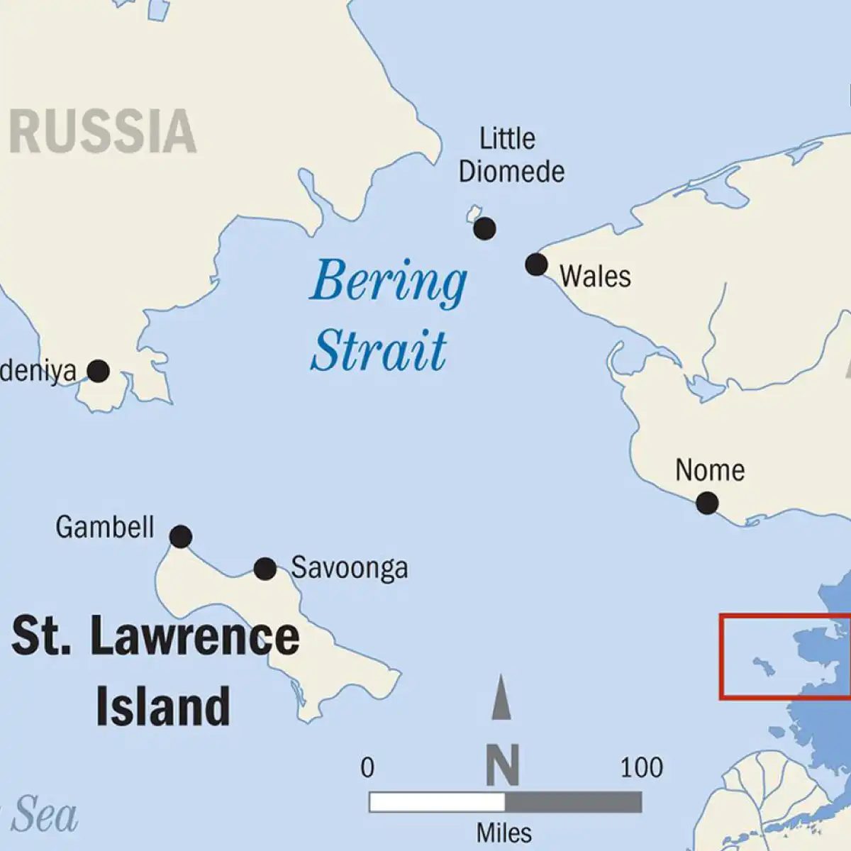
Berbeda dengan Selat Messina yang ramai lalu lintas feri wisata dan komersial, Selat Bering memiliki karakter yang jauh lebih dingin dan terpencil. Letaknya di ujung timur laut Rusia dan ujung barat laut Alaska, Amerika Serikat, selat ini menjadi pemisah fisik antara dua benua: Asia dan Amerika Utara.
Bagi pelajar geografi, ini adalah contoh nyata bagaimana garis batas buatan manusia bertemu dengan realitas alam yang keras. Lebar selat ini bervariasi, dari sekitar 85 kilometer di bagian utara hingga sekitar 90 kilometer di bagian selatan. Di titik tersempitnya, antara Pulau Diomeda Besar (Rusia) dan Pulau Diomeda Kecil (AS), jaraknya hanya sekitar 3,8 kilometer.
Mengapa Selat Bering Penting?
Pertanyaan utamanya bukan hanya “di mana”, tapi “mengapa selat ini signifikan”.
- Perbatasan Geopolitik : Selat ini menandai batas negara antara Rusia dan AS. Bahkan, garis batas internasional dan tanggal perubahan (International Date Line) berjalan melalui sini. Jika Anda berdiri di Pulau Diomeda Kecil pada hari Jumat, dan menyeberang ke Pulau Diomeda Besar, Anda secara teknis masuk ke hari Sabtu.
- Ekosistem Lautan Arktik : Air di sini tidak seperti Mediterania yang hangat. Ia membeku sebagian besar tahun, membentuk lautan es yang mempengaruhi pola migrasi paus, anjing laut, dan spesies laut lainnya. Perubahan iklim mengancam stabilitas es ini secara langsung.
- Rute Maritim Masa Depan : Dengan mencairnya es Arktik, Selat Bering diprediksi akan menjadi bagian dari “Rute Laut Utara” atau Northern Sea Route. Ini menawarkan jalan pintas potensial antara Asia Timur dan Eropa Barat, menghemat waktu dibandingkan melalui Terusan Suez. Namun, infrastruktur dan keamanan di sana masih sangat terbatas.
Bagaimana Kondisi Navigasinya?
Berlayar di Selat Bering tidak seperti mengambil feri di Italia. Cuaca bisa berubah drastis dalam hitungan jam. Kabut tebal, badai salju, dan es terapung (icebergs) adalah bahaya nyata.
- Musim Pelayaran : Jendela waktu untuk pelayaran komersial atau ilmiah sangat singkat, biasanya hanya di bulan Juli hingga Oktober saat es mencair maksimal.
- Lalu Lintas Terbatas : Tidak ada feri penumpang reguler yang menghubungkan Rusia dan AS. Perjalanan darat melalui jembatan atau terowongan masih berupa proyek spekulatif karena biaya dan tantangan teknis yang sangat tinggi.
- Aktivitas Lokal : Penduduk asli Chukchi di Rusia dan Inupiat di Alaska bergantung pada laut untuk subsisten. Perikanan dan perburuan tradisional masih menjadi mata pencaharian utama di wilayah pesisir selat ini.
Per
The Strait of Magellan: Navigating the Southern Tip
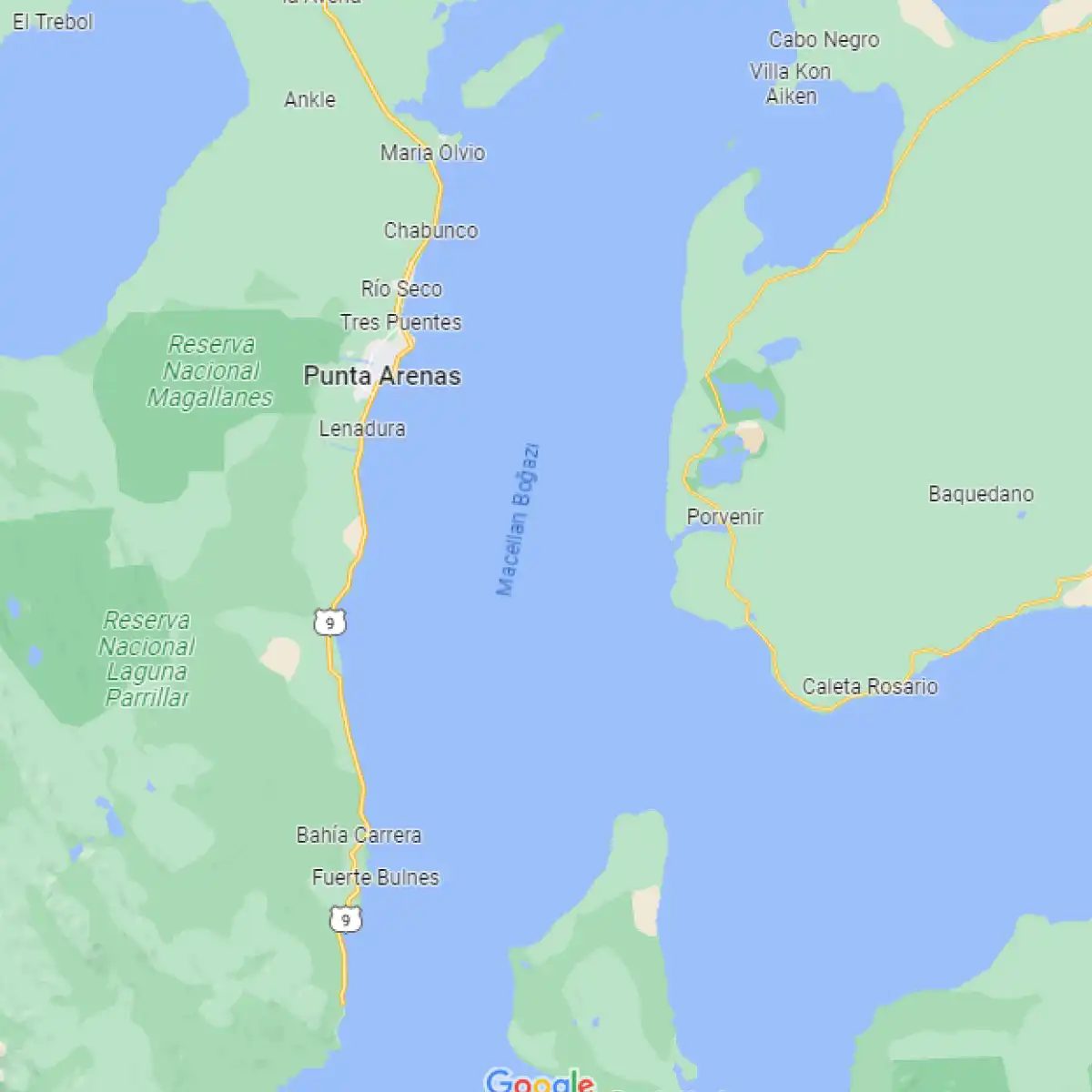
If you are looking for the choke point that forces ships to choose between a long trek around South America or a risky crossing of the Panama Canal, the answer is clear. Located at the southern tip of South America, this waterway separates the mainland from Tierra del Fuego. It serves as a critical maritime corridor between the Atlantic and Pacific Oceans, a fact that makes understanding how to navigate the Strait of Magellan essential for anyone interested in global shipping routes.
History here is heavy. Ferdinand Magellan first sailed through it in 1520 during his quest to circumnavigate the globe. The route was not easy. The winds here are notorious. They can shift violently, turning a calm day into a survival test. For centuries, this was the only way for large vessels to move between the two oceans. Before the Panama Canal opened in 1914, this strait was the lifeline of global trade. Ships had to brave its narrow channels and unpredictable currents. Today, it remains a viable alternative for vessels that are too large to pass through the canal or those seeking a more direct route to the west coast of the Americas.
The geography is stark. The strait splits the Patagonian archipelago. To the south lies Tierra del Fuego, shared by Chile and Argentina. To the north, the rugged coastline of Chilean Patagonia drops sharply into the sea. The distance from the entrance to the exit is about 350 kilometers. It is not a straight shot. The channel winds through a maze of islands and fjords. This complexity is why which route to take through the Strait of Magellan is a matter of serious planning. Pilots must read the tides carefully. The currents can push a ship sideways with surprising force.
Why does this matter now? Climate change is altering ice patterns in the region. While the strait itself remains ice-free for most of the year, the surrounding glaciers are retreating. This affects local ecosystems and navigation safety. For travelers, the view is dramatic. Towering granite peaks rise from the water. Glaciers calve into the sea with thunderous cracks. It is a landscape that demands respect.
The town of Punta Arenas in Chile serves as the primary gateway. Ships often stop here for supplies before entering the strait. Local economies rely heavily on this traffic. Fishing and tourism are also key industries. The region is remote. Supplies must be brought in or shipped out. This isolation gives the area a unique character. The wind is constant. It shapes the trees and the buildings. It is a place where nature holds all the power.
Comparing this to other major straits like the Suez Canal or the Strait of Gibraltar reveals different challenges. Those routes are narrower and more congested. The Strait of Magellan offers more space but more weather-related unpredictability. It is less about traffic control and more about endurance. For sailors, it is a rite of passage. For cargo ships, it is a strategic option.
The waters are deep in many places. But shallow bars exist near the entrances. These require precise navigation. Modern GPS has made the journey safer. But the wind remains a wild card. You cannot control it. You can only adapt to it. This is the reality of sailing in this region. It
How the Malacca Strait Changed Global Trade
Far south in Chile, the Strait of Magellan cuts through the ice and wind, linking the Atlantic and Pacific Oceans. It separates the mainland from Tierra del Fuego. Before the Panama Canal opened in 1914, this passage was the only way for ships to bypass the dangerous southern tip of South America. It still sees traffic today, though far less than in its heyday. But while the Magellan Strait fought the elements, another choke point was quietly becoming the busiest waterway on Earth.
Why the Malacca Strait is the World’s Busiest Shipping Lane
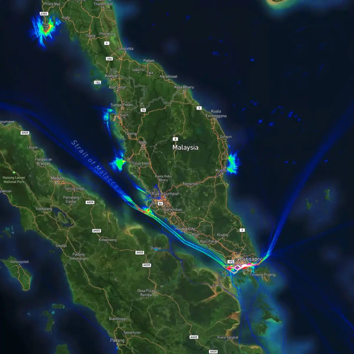
Located in Southeast Asia, the Malacca Strait stretches about 800 kilometers between the Indonesian island of Sumatra and the Malaysian peninsula. It connects the Indian Ocean to the South China Sea. This isn’t just a random shortcut. It is the most critical maritime corridor for global commerce.
Ships carrying oil from the Middle East to Asia must pass through here. Electronics components from China and Japan flow through these waters to reach American and European markets. If this narrow strip of water gets blocked, the global supply chain shudders.
The History Behind the Current
The name comes from the Malay city of Malacca, which was once a thriving trading hub. Portuguese, Dutch, and British powers fought over control of this route for centuries. They knew that controlling the strait meant controlling the flow of spices, silk, and gold.
Today, the strait is governed by three nations: Indonesia, Malaysia, and Singapore. Each has a stake in keeping it open and secure. Singapore, sitting at the southern tip, uses its position to become one of the world’s busiest ports. It is a natural refueling and logistics center for any vessel moving between the two oceans.
How Ships Navigate the Choke Point
The strait is narrow. At its tightest point, it is only 2.8 kilometers wide. Deep-draft vessels, especially those carrying liquefied natural gas (LNG) or crude oil, have to move slowly. They follow specific shipping lanes to avoid running aground on the many sandbanks and reefs.
Traffic is heavy. Hundreds of ships pass through every day. This density creates risks. Collisions can happen. More pressing is the threat of piracy. In the past, pirates used the shallow waters and dense jungle cover to attack slow-moving tankers. International naval patrols have reduced incidents significantly, but vigilance remains high.
Economic Impact of the Passage
The Malacca Strait handles more than a quarter of the world’s imported goods. It is estimated that around 80,000 ships cross these waters annually. The economic stakes are immense. A disruption here would raise shipping costs globally. Fuel prices would jump. Consumer goods would become scarce.
Countries that rely on imported energy, like Japan, South Korea, and China, watch this strait closely. Their economies depend on its uninterrupted flow. This dependency has led to diplomatic tensions and strategic investments in alternative routes, though none have replaced the Malacca Strait’s efficiency.
What is Being Done to Improve Safety?
Coastal states invest heavily in lighthouses, radar systems, and traffic monitoring centers. The Singaporean Maritime and Port Authority works with Malaysian and Indonesian counterparts to enforce rules. They track every large vessel to prevent accidents and illegal activities.
There are also discussions about digging alternative
Dover Strait: The Choke Point for Europe
If you think the Malacca Strait is busy, just look across the water to Europe. The Strait of Dover sits between the United Kingdom and France, connecting the North Sea to the rest of the Atlantic. It is arguably the most congested waterway on the planet.
Why does it matter? Because nearly all cargo moving between Northern Europe and the global market must squeeze through this narrow gap. The distance is incredibly short—only about 21 miles (33 kilometers) at its narrowest point. Ships have little room to maneuver. You have commercial freighters, ferries carrying passengers, and fishing boats all sharing the same tight lanes.
The volume here is staggering. In a single day, hundreds of vessels pass through. That includes oil tankers, container ships, and cruise liners. For shippers, time is money, and delays here ripple through the entire European supply chain. If a ship breaks down or gets stuck in fog, the backlog is immediate.
This is why the Dover Strait is often cited in logistics discussions. It is not just a geographic feature; it is a critical economic artery. Understanding how traffic is managed here reveals the complexity of modern global shipping. One accident can halt trade for miles.
The Strait of Dover proves that geography still dictates economics. No matter how advanced our logistics systems become, we still depend on these natural choke points. The next time you buy something made in Asia and sold in London, remember it likely navigated this narrow, crowded passage.
The question remains: how long can such a fragile bottleneck sustain current trade volumes? As shipping grows, so does the pressure on these straits. Dover is just the beginning of the conversation about maritime congestion.
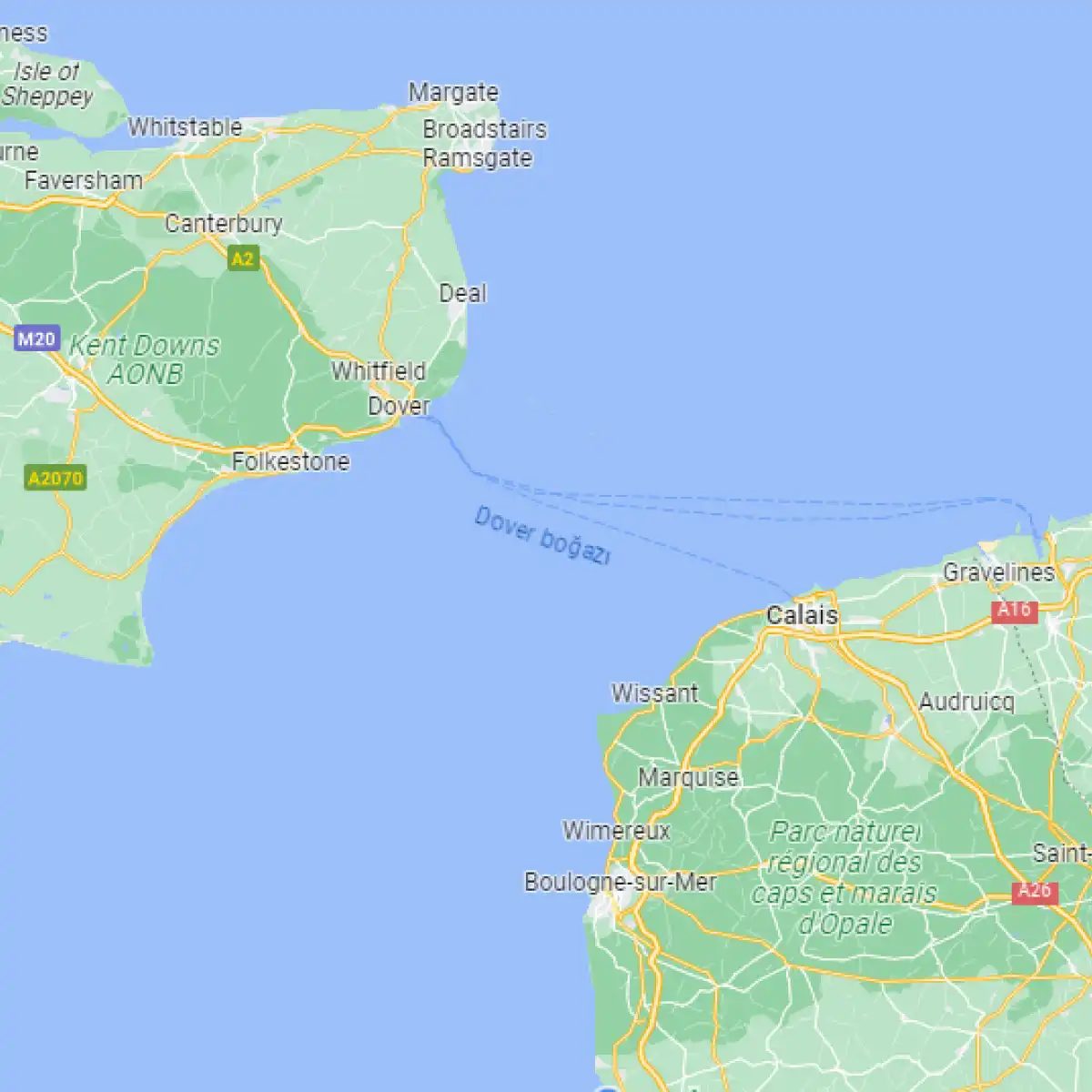
Dover Boğazı sadece bir su yolu değil, tarihin tozlu sayfalarında bile silinmez bir stratejik aktör. Büyük Britanya’yı Avrupa kıtasından ayıran bu boğaz, Kuzey Denizi ile Manş Denizi’nin buluştuğu yerde, adeta bir kapı gibi duruyor. Askeri açıdan bakıldığında da önemi yadsınamaz. Neden mi? Çünkü İngiltere’nin ana kara ile olan bağlantısını koparan tek doğal sınır burası. Yüzyıllardır işgal tehlikesinden savunan, ticaret yollarını kontrol eden ve düşman limanlarına erişimi kısıtlayan bir kale rolü üstleniyor.
Bu stratejik değere sahip boğazların yanı sıra, insan eliyle açılmış devasa kanallar da dünya ticaretinin nabzını tutuyor.
Önemli Su Kanalları Listesi
Dünya üzerindeki ana arterlerden bazıları şunlar:
- Kiel Kanalı (Almanya): 98,26 km uzunluğunda.
- Panama Kanalı (Panama): 82 km uzunluğunda.
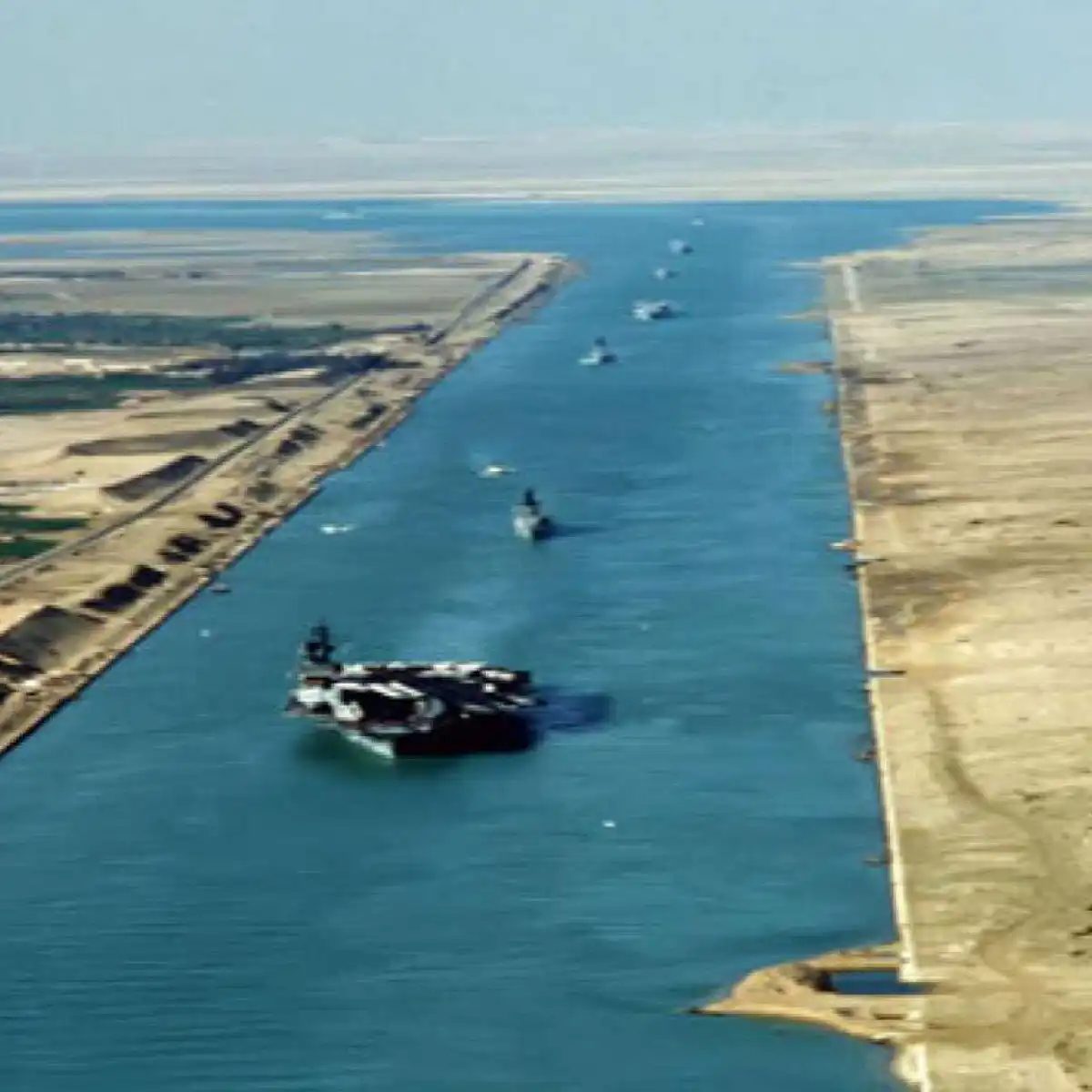
- Süveyş Kanalı (Mısır): 193 km uzunluğunda.
Bu üç kanal, küresel lojistik ağının temel taşları. Her biri farklı coğrafyada, farklı bir soruna çözüm üretmiş.
Dünyanın en önemli 3 kanalı
Ticari gemilerin yılda milyarlarca dolarlık yük taşıdığı, deniz yollarının en yoğun olduğu yerler. İşte bu devasa yapılar:
1. Kiel Kanalı
Almanya’nın kuzeyinde, Schleswig-Holstein eyaletinde bulunan Kiel Kanalı, sadece bir su yolu değil, kuzey Avrupa’nın ekonomik can damarı. 98,26 kilometrelik bu yapay kanal, Kuzey Denizi ile Baltık Denizi’ni birbirine bağluyor.
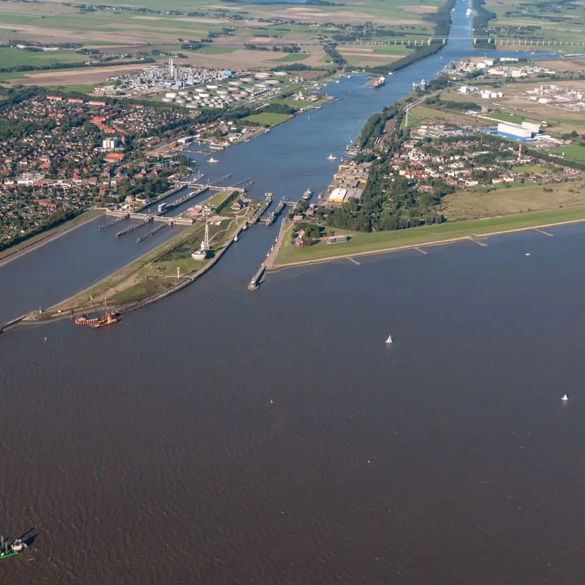
Bu kanal, Kuzey Denizi’ndeki Elbe Nehri ağzından başlayarak Baltık Denizi kıyısındaki Kiel Limanı’na kadar uzanır. Sadece bir su yolundan ibaret değil, gemiler için kuzeye giden rotaları büyük ölçüde kolaylaştıran kritik bir kısaltmadır. Ticaret ve denizcilik sektörlerinde önemli bir rol oynayan kanal, genişlik ve derinlik açısından devasa gemilerin sorunsuz geçişine olanak tanır.
2. Panama Kanalı
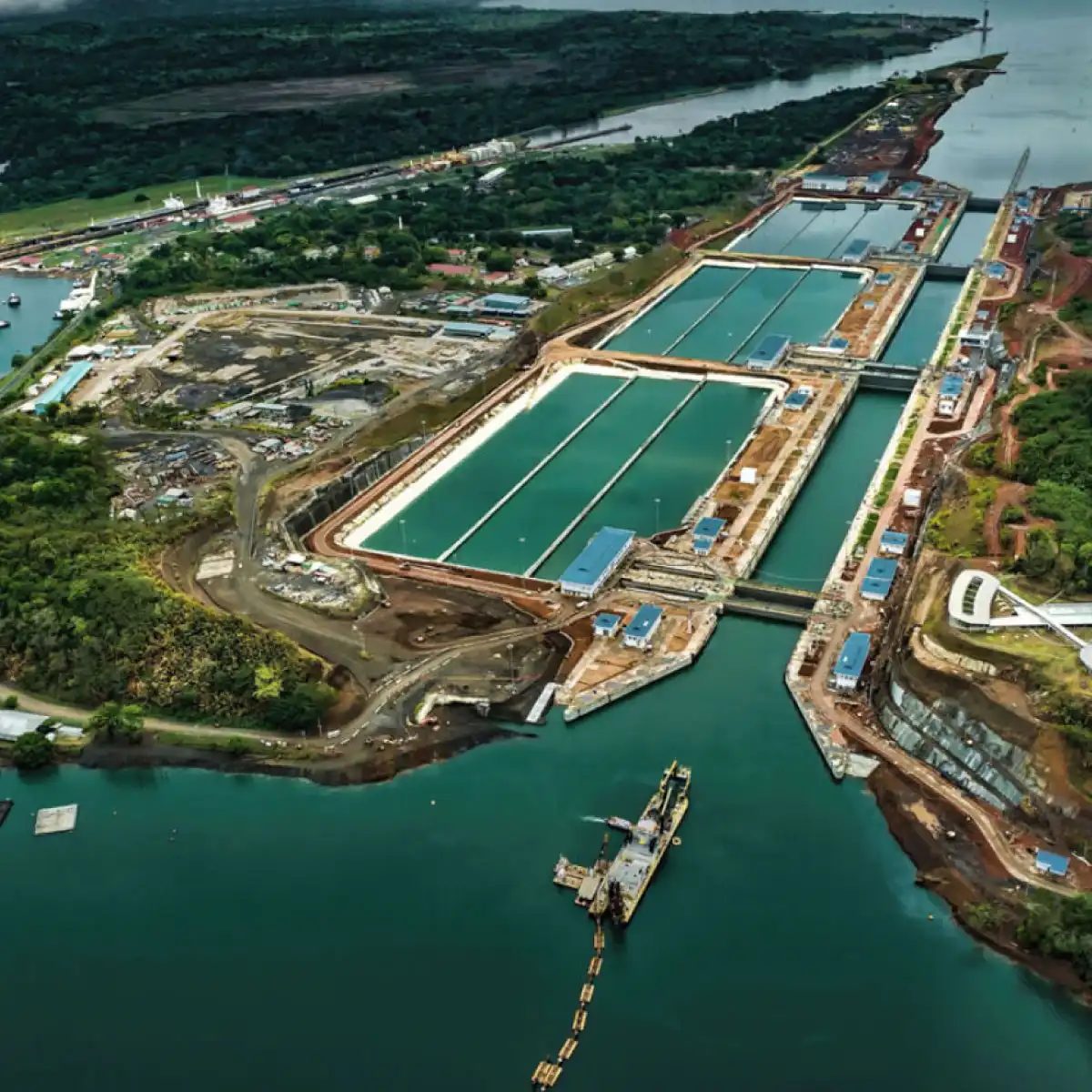
Panama Kanalı, Orta Amerika’nın dar boğazında, Panama toprakları üzerinde hizmet veren devasa bir su yoludur. Atlas Okyanusu’nu Büyük Okyanus’a bağlar. Bu proje, mühendislik tarihinin en zorlu mücadelelerinden biri olarak kabul edilir. İnşaat sırasında binlerce işçi yaşamını yitirdi. Kanal tamamlandığında, gemilerin kat edeceği mesafe 10.000 km’ye varan oranlarda kısalıp uluslararası ticaretin hızı ve verimliliği arttı.
İLGİNİZİ ÇEKEBİLİR
Panama Kanalı
3. Süveyş Kanalı
Dijital dünyada kalabalık, değil mi? Herkes aynı hatayı yapıyor. Uzaktan öğrenmeyi sadece “evden çalışmak” sanıyor. Yanlış. Bu, disiplin ve zaman yönetimi oyunu. Peki, gerçekten işe yarıyor mu?
Disiplin Kurmanın Püf Noktaları
Evde okumak kolay gelseydi herkes mezun olurdu. Gerçek şu: Masana oturmak yeterli değil. Ortamı düzenle. Telefondan arayanları sustur. Bir saat belirle. O saat bitmeden kitap kapatılmaz.
Beyin, sabahları daha net çalışır. Bu saatleri en zor derslere ayır. Kolay olanları akşama bırak. Bu küçük strateji, motivasyonun tükenmesini engeller.
“Başarı, büyük sıçramalarla değil, küçük, tutarlı adımlarla gelir.”
Zaman Yönetimi İçin Pratik Adımlar
Günde 4 saat çalışmak yerine, 1 saat odaklanmak daha iyi. Pomodoro tekniği işe yarar. 25 dakika çalış. 5 dakika mola ver. Bu döngü beyni yormadan bilgi almasını sağlar.
Takvimini renklendir. Her ders için farklı bir renk. Görünür olan, hatırlanandır. Planını sabah yap. Akşam değiştirme. Sabahki kararlar daha sağlamdır.
Teknolojiyi Düşman Değil, Dost Olarak Gör
Uygulamalar çoğu zaman şaşırtıcı derecede faydalı. Not alma uygulamaları, sesli kayıt özellikleri, çevrimiçi kütüphaneler. Bunları kullanmıyorsan, geride kalıyorsun demektir.
Diğer öğrencilerle paylaştığın notlar, eksiklerini tamamlar. Grup sohbetleri sadece sosyal medya değil, öğrenme aracı. Soru sor. Cevap al. Öğrenmek bir etkileşimdir.
Motivasyonu Koruma Yöntemleri
Sınav yaklaştıkça panik artar. Bu normal. Ancak panik çözüm üretmez. Derse bölün. Büyük hedefleri küçük parçalara ayır. Her parça tamamlandığında beynin dopamin salgılar. Bu, devam etme isteği verir.
Başarısızlık, son değildir. Dönüş noktasıdır. Yanlışını analiz et. Nerede hata yaptığını bul. Tekrar dene. Bu döngü, öğrenmenin özüdür.
Sosyal İlişkiler ve Destek Sistemi
Evde yalnız kalmak, verimsizliğe sürükleyebilir. Haftada bir kez arkadaşlarınla buluş. Sadece sohbet etmek için değil, öğrenme hedeflerinizi paylaşmak için. Dışarıdan gelen destek, içsel gücü güçlendirir.
Aile desteği de önemli. Onlara neye ihtiyacın olduğunu söyle. Sessiz bir ortam. Belirli saatlerde rahatsız edilmeme. Bu küçük talepler, büyük fark