Turkey’s landscape isn’t just scenic; it’s geologically active. The country’s topography emerged from a violent mix of natural forces. Erosion, sedimentation, and volcanic eruptions all played major roles. These processes didn’t happen overnight. Over millions of years, they carved the valleys, raised the mountains, and smoothed the plateaus.
Understanding how these features formed helps explain why Turkey looks the way it does today. It turns a map into a story of pressure, heat, and water. For students and curious travelers, this context matters. It shows that the ground beneath your feet is still settling and shifting.
The Role of Erosion and Sedimentation
Water moves rocks. Wind strips soil. Ice polishes stone. Erosion breaks down large structures into smaller pieces. Sedimentation then moves those pieces to new locations. This cycle fills basins and builds deltas. In Turkey, rivers like the Kızılırmak and Sakarya have transported sediment for eons. They deposited layers that now form fertile plains.
Why does this matter? Because it explains the contrast between rugged highlands and flat agricultural zones. The highlands resisted erosion. The lowlands accepted the debris. This dynamic created the diverse landscapes you see across Anatolia.
Türkiye’nin bugünkü hâli, binlerce milyon yıllık bir inşa sürecinin ürünü. Bu süreci anlamak, coğrafyayı sadece harita üzerinde değil, derinlikte okumayı gerektirir. Bir önceki bölümde Paleozoik dönemdeki temel taşları ele almıştık. Şimdi sıra, bu sert tabakaların üzerine yığılan ve şekli değiştiren ikinci büyük aşamada: Mesozoik’te.
Mesozoik dönemi: Denizlerin çekilmesi ve yumuşak kayaların oluşumu
Paleozoik döneminde Tethys Denizi’nin dibinde biriken tortullar kıvrılınca sert, yaşlı kütleler (masifler) ortaya çıkmıştı. Mesozoik dönemi ise bu sürecin devamı ve dönüşümüdür. Bu evrede, kuzey ve güneydeki kıta çekirdekleri arasındaki deniz alanı daralmış ama tamamen kapanmamıştır.
Burada kritik bir fark var. Paleozoik arazileri gibi sert ve oturmuş tabakalar değil, daha gevşek, genç ve erimeye/yıpranmaya daha yatkın birimler oluşmuştur. Bu dönemde biriken tortul tabakalar, genellikle kireçtaşı, marn, kumtaşı ve çökelti kayaçlarından meydana gelmiştir.
Jeolojik devirler arasındaki en temel ayrım, yerkabuğu olayları ve bu olayların yarattığı kayaç sertliğidir.
Bu dönem Türkiye için neden önemli? Çünkü bugün ülkenin büyük bir kısmının yer aldığı alanlar, Mesozoik döneminde deniz dibi veya sığ göl tabanlarıydı. Tethys Denizi’nin kıyıları, bugünkü İç Anadolu, Ege ve Güneydoğu Toroslar gibi bölgelerdi. Deniz çekildikçe bu tortullar birikti, zamanla katılaşarak günümüzdeki yumuşak ve hatta çökme riski taşıyan arazilerin temelini attı.
Türkiye’de Mesozoik arazileri nereden tanırsınız?
Mesozoik döneminin izlerini Türkiye’de görmek için coğrafyaya bakmak yeterlidir. Bu döneme ait en belirgin özelliklerden biri, arazilerin depreme karşı Paleozoik masifler kadar dirençli olmamasıdır. Yumuşak kayaklar, yer altı suları ve zamanla erozyona daha hızlı boyun eğer.
Bilim insanları, bu döneme ait fosilleri inceleyerek hangi tabakaların ne zaman biriktiğini çözer. Tortul katmanlar arasında bulunan amonyit, pliosür ve diğer deniz canlısı kalıntıları, Mesozoik zamanın denizel ortamını kanıtlar.
Mesozoik arazilerin yaygın olduğu başlıca bölgeler şunlardır:
- Toroslar Dağları’nın büyük bir bölümü: Özellikle Güney Toroslar, Mesozoik döneminde biriken kireçtaşı ve marn tabakalarından oluşur.
- İç Anadolu’daki platolar: Konya Ovası ve çevresindeki yumuşak yapılar, bu dönemin tortullarının bir ürünüdür.
- Ege Bölgesi’nin iç kesimleri: İzmir ve Manisa çevresindeki bazı yumuşak kayaklı alanlar.
- Karadeniz Dağları’nın güney yamaçları: Paleozoik masiflerin üzerine bindirilen Mesozoik tortullar.
Bu bölgelerde toprak örtüsü genellikle inceld
How the Tethys Sea Shaped Anatolia’s Mountains
The landscape you see today didn’t just appear. It was built, squeezed, and broken over millions of years. Before the Alps had a name, most of Turkey was underwater. During the Mesozoic era, the Tethys Sea covered the region. Sediments carried by currents settled on the seafloor: sand, silt, gravel, and limestone. Then the plates started moving again. The old continental cores to the north and south began pushing toward each other.
That pressure didn’t just nudge the rocks. It folded them. The accumulated sediments at the bottom of the Tethys Sea crumpled under the weight of converging plates. This is where the skeleton of modern Turkey began to take shape.
Why Tertiary Era Marked the Birth of Modern Turkey
If you want to know when Turkey’s terrain truly formed, look at the Tertiary period. This is the most critical phase in the country’s geological history. The Alpine orogeny hit hard. The sediments that had built up in the Tethys Sea were crushed and folded into massive landmasses.
This process turned a large portion of Anatolia from sea floor to land. The violence of these tectonic movements created the ranges we know today. The Taurus Mountains rose in the south. The North Anatolian Mountains formed in the north. While the edges were being pushed upward, the interior began to sink, creating basins that would eventually fill with water.
The climate wasn’t just shaping the rocks. It was shaping the resources.
Tropical-like conditions brought humid, warm weather and dense vegetation. Organic matter from these lush forests washed into the inland lakes. Over time, that material compressed into the lignite deposits found in Turkey today.
Other geological treasures emerged during this same window. Salt deposits formed in the Inner and Eastern Anatolia regions. Petroleum and borate deposits appeared in the Southeast. The Tertiary era wasn’t just about mountains. It was about filling the land with fuel and minerals.
How the Quaternary Era Carved Modern Turkey
The final act in Turkey’s geological story is the Quaternary era. This is when the country looked like what it does now. The Taurus and North Anatolian Mountains continued to rise. But the land didn’t just go up. It also broke.
New depressions formed. The Black Sea and Mediterranean basins deepened. Horst and graben structures emerged, creating the rugged terrain of the western regions.
Consider the Aegean Sea. It wasn’t always a sea. There was a landmass called “Egeid Land” where the water sits today. During the Quaternary period, that land sank. Mediterranean water poured into the cracks and basins, creating the Aegean Sea we know today.
This process also connected the seas. The Bosphorus and Dardanelles straits opened up. Mediterranean water flowed into the Black Sea. Before this connection, the Black Sea was a freshwater body. After the mixing, it became saline. A simple geological shift changed the chemical makeup of an entire sea.
Volcanism played a starring role in the east. The Eastern Anatolia region saw widespread volcanic activity during this time. Volcanic mountains rose from the earth. The Aegean Islands and Cyprus also formed during this period.
Climate changes added another layer. Intense shifts in weather led to glaciation in the high-altitude areas of Eastern Anatolia. Ice sheets moved across the landscape, carving valleys and reshaping peaks.
The result is a complex terrain. Mountains folded from ancient sea beds. Seas formed from sunken landmasses. Volcanoes built new islands. Glaciers polished the rest. Turkey’s geography is a palimpsest, with each era writing over the last.
How tectonic forces built Turkey’s mountain ranges
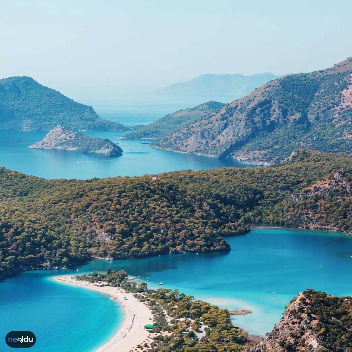
Türkiye is packed with mountains. The density is high because the land itself is moving. Geologists trace this landscape to specific tectonic shifts. You are looking at the result of plates grinding against each other over millions of years. The process is not finished. It continues today, slowly but steadily.
Where the North Anatolian Fault creates peaks
The North Anatolian Fault runs through the northern part of the country. It is active. Measurements show it shifts about 2 cm every year. That speed sounds small. It is not. Over time, that movement lifts the crust. The North Anatolian Mountains exist because of this stress. They stretch from east to west. The terrain here reflects the ongoing pressure from the fault line below.
Why the East holds Turkey’s highest point
In the east, the East Anatolian Fault takes center stage. This zone moves slower than its northern counterpart. The shift is roughly 1 cm per year. Even that pace builds elevation. The East Anatolian Mountains rose from this friction. Mount Ararat sits within this region. It is one of the country’s highest peaks. The tectonic history of the eastern highlands is distinct from the north.
How the Mediterranean Fault shaped the Taurus range
Southern Turkey tells a different story. The Mediterranean Fault operates in the south. It also experiences movement of about 1 cm annually. This slow push created the Taurus Mountains. They form Turkey’s longest mountain range. The alignment and scale of this chain are direct products of the tectonic activity along the southern border.
What role erosion plays in shaping the landscape
Tectonics built the bones. Weathering built the face. Erosion and sedimentation are not just background processes. They actively sculpted the surface. These forces carved valleys, smoothed ridges, and deposited material. The mountains you see today are a mix of uplift and wear. The final form is a result of both pushing up and breaking down.
Tectonic movement creates the structure. Erosion defines the shape.
How these factors combine to form current landforms
The creation of Turkey’s mountains is not a single event. It is a combination of forces. Tectonic plates provide the vertical lift. Geological processes like erosion refine the details. The interplay between these elements explains the diversity of the landscape. From the rugged peaks of the east to the long ridges of the south, each range has a specific tectonic origin. Understanding the fault lines helps explain why the terrain looks the way it does today. The land is still adjusting. The story of these mountains is still being written, one centimeter at a time.
How plate collisions shaped Turkey’s landscape
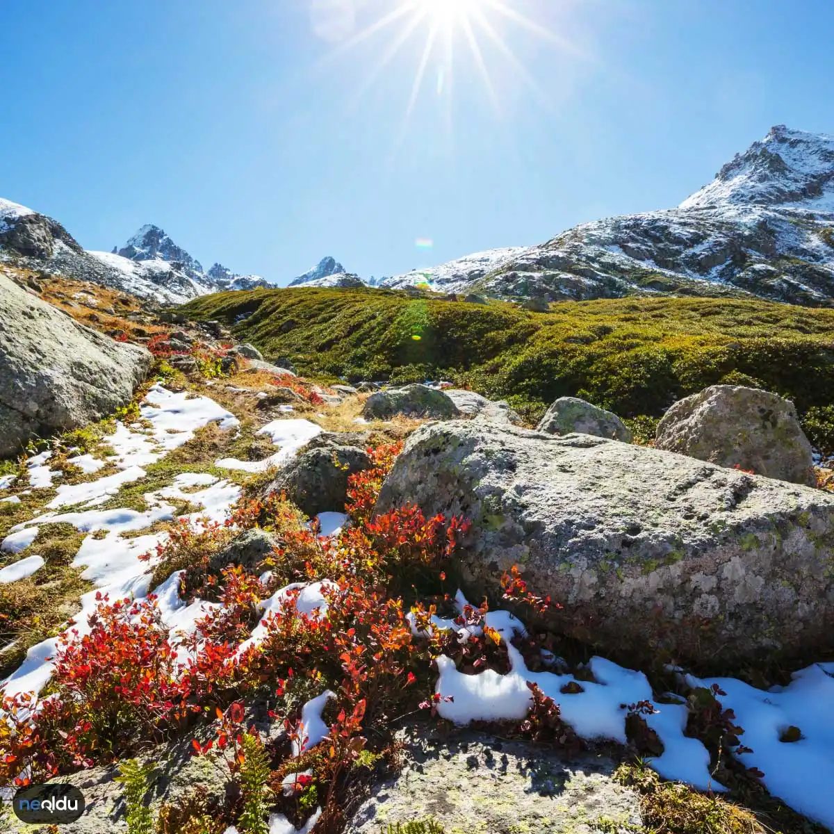
Turkey sits on a restless crust. The country’s terrain isn’t random; it’s the direct result of massive tectonic forces pushing against each other. The Anatolian Plate is squeezed between the African and Arabian plates to the south and east, while the Eurasian Plate presses in from the north. This three-way compression is why the ground shakes so often and why the land looks so rugged.
You rarely see a country with such extreme elevation changes packed into one map. The high peaks and deep valleys are evidence of this ongoing geological stress. The mountains you see are not just scenic; they are the visible scars of plates grinding against one another.
Which mountain ranges are formed by tectonic pressure?
Two main systems dominate the landscape, and they tell different stories about how the land broke and lifted.
The North Anatolian Mountains run along the northern coast. They stretch from the eastern Black Sea region all the way to the East Anatolian region. The North Anatolian Fault Line is the engine behind them. As the blocks of earth slid and faulted, these ridges were pushed up.
Then there is the Taurus Mountains (Toros Dağları) in the south. These sit in the Southern Anatolian region. They formed through a similar process of tectonic compression but in a different directional push. If you look at the map, you can see how the southern edge of the country is essentially a wall of rock lifted by the African Plate pushing north.
Why volcanic activity clusters in specific regions
It’s not just about mountains. The same tectonic setup creates the conditions for volcanoes. You won’t find them scattered evenly. The activity is concentrated in two main zones:
- Eastern Anatolia
- Northern Black Sea region
These areas are the most volcanically active in the country. The pressure builds, the crust weakens, and magma finds its way up. This process doesn’t just create peaks; it creates volcanic plateaus. The flat, elevated areas you might see in the east are often the result of ancient lava flows filling basins created by tectonic movement.
The link is direct. No plate collision, no pressure. No pressure, no mountains or volcanoes. The geography is the history of the plates written in stone.
How tectonic forces carved Turkey’s mountain ranges
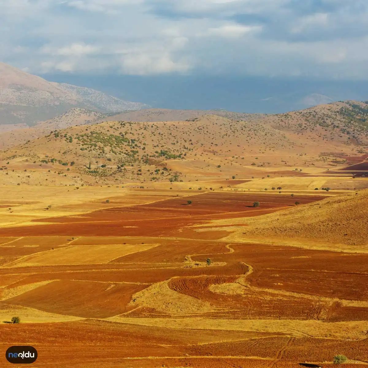
The ground beneath your feet in Turkey isn’t static. It’s shifting. The country sits right on the North Anatolian Fault Line, the friction zone where the Anatolian plate grinds against the Eurasian plate. This collision is violent. It’s the primary engine behind the region’s frequent earthquakes, but it’s also the sculptor of its landscape. When the crust snaps and shifts, it creates vertical offsets. These aren’t just cracks; they are the foundational structures for massive mountain systems.
The Mount Ararat, the tallest peak in the country at 5,137 meters, stands in the Eastern Anatolia region as a direct testament to these tectonic pressures. It didn’t just appear; it was pushed upward by the same deep-seated forces that drive seismic activity. To the south, the Taurus Mountains (Toros Dağları) emerged as the fault systems extended eastward, layering rock strata and raising the landmass.
Why volcanic activity defines the eastern and northern landscape
Earthquakes break things. Volcanoes build them.
Turkey’s volcanic hotspots are concentrated in Eastern Anatolia and the northern Black Sea region. Here, magma breaches the surface, not just destroying, but adding material. These eruptions created volcanic plateaus and rugged highlands that dominate the eastern skyline. The interplay between rising magma and cooling rock formations gives these areas a distinct geological character, separate from the purely fault-driven landscapes of the center.
How lakes and canyons formed from erosion and tectonic shifts
The water bodies and deep cuts in Turkey’s terrain are the result of slower, persistent processes.
- Lakes : You’ll find crater lakes formed when volcanic vents filled with water. Tectonic lakes appeared where the ground sank into basins due to plate movement. Erosional lakes formed as rivers carved out depressions, while glacial activity filled depressions left by retreating ice.
- Canyons : These are largely the work of rivers. Over millennia, flowing water scoured the rock, widening and deepening channels into dramatic gorges. It’s a slow process, but the results are stark.
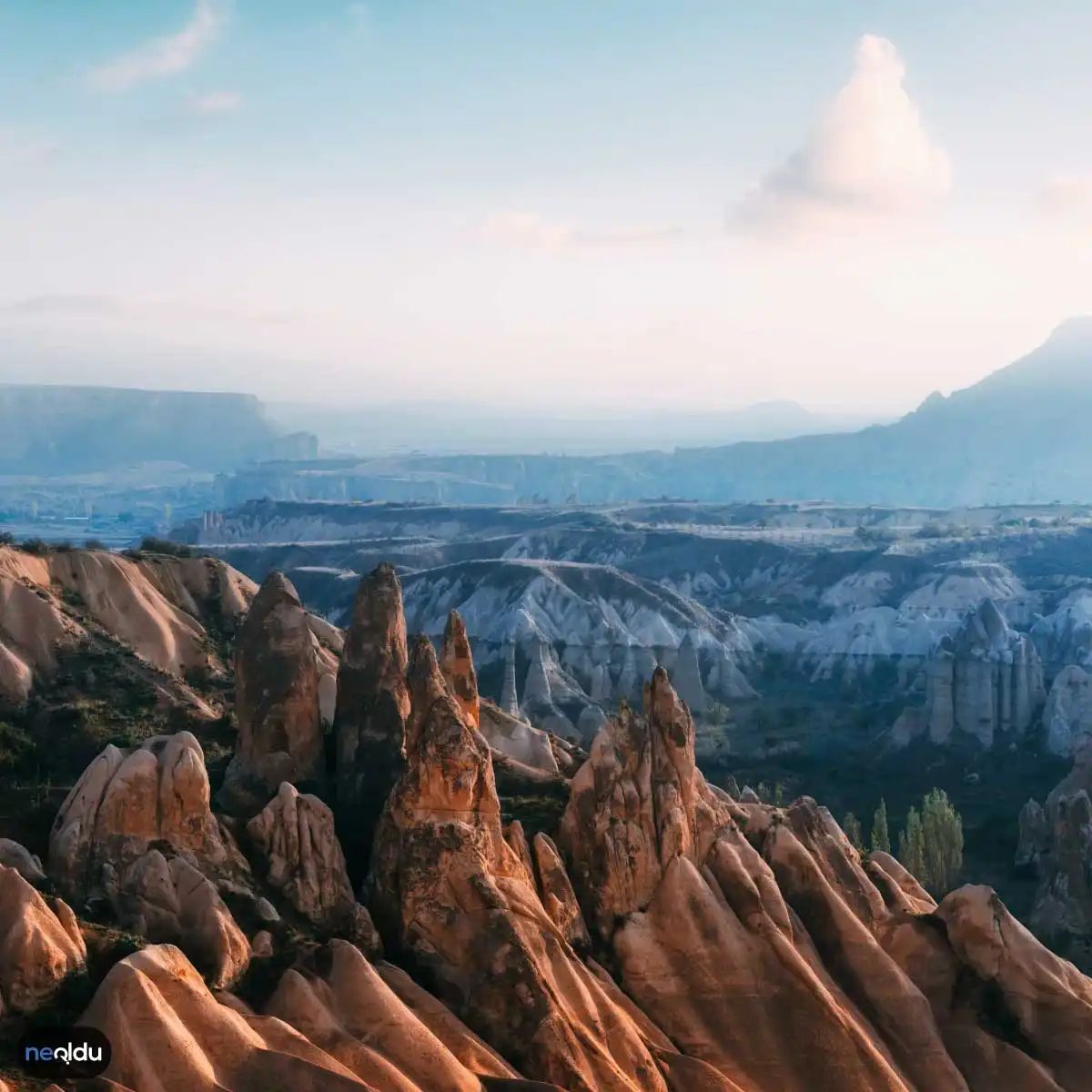
- Plateaus : These high, flat surfaces often result from tectonic uplift followed by extensive erosion. The mountains wore down, leaving flat-topped remnants, or the ground was lifted and then stripped of its top layers by wind and water.
Which geological processes shape Turkey’s terrain?
It’s a mix of violent rupture and patient abrasion.
- Tectonic Movement : The primary driver. Plate collisions build mountains and create fault lines.
- Volcanism : Adds new landmasses and creates specific lake types in the east and north.
- Erosion : Rivers, wind, and ice wear the landscape down, creating canyons, valleys, and shaping the final contours of the plateaus.
The geography of Turkey is a palimpsest. Every ridge, every lake, and every canyon is a record of a specific force acting over millions of years. The fault lines that make the country seismically active are the same ones that lifted its highest peaks. The rivers that carve its canyons also help define the basins that hold its lakes. To understand the land, you have to understand the forces that never stop moving it.